|
|
Disclaimer: LightningWizard cannot guarantee 100% timeliness of fresh maps, nor the reliability of the plotted parameters and consistent layout of the maps.
Remember that models only try to reproduce reality. Use at your own responsibility, and verify by use of other models and observations.
For questions and suggestions, email me.
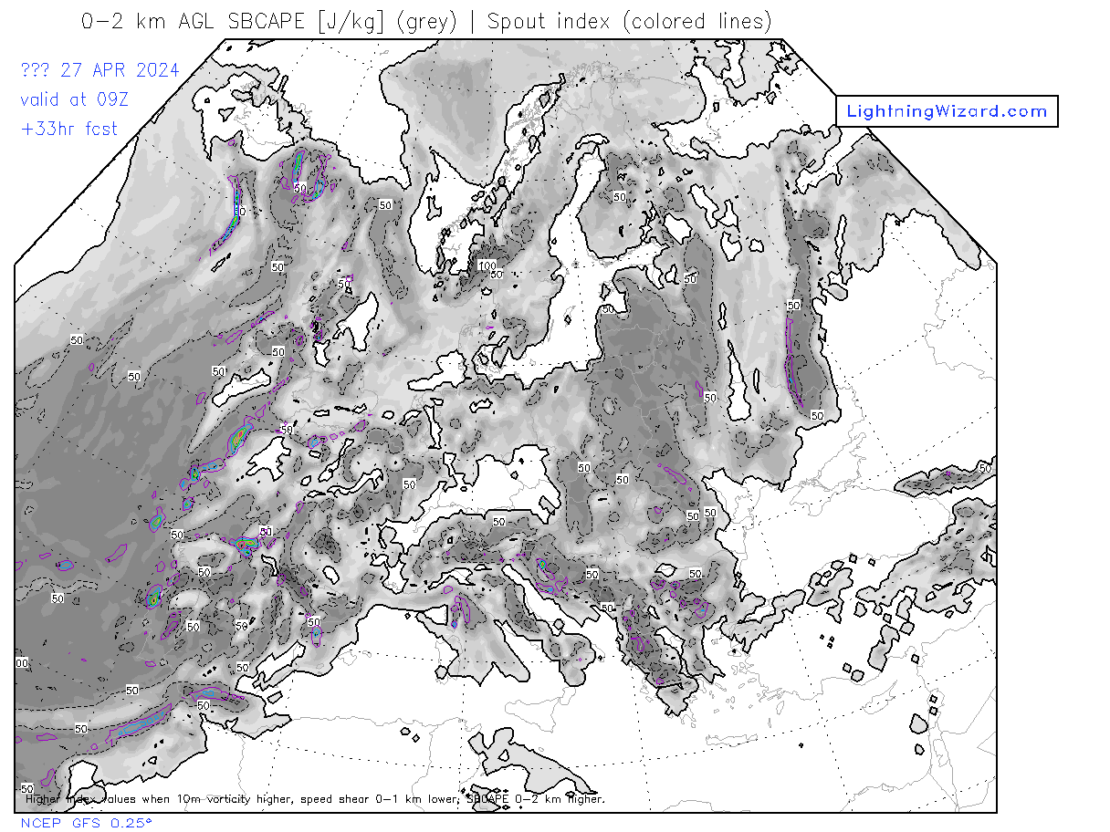
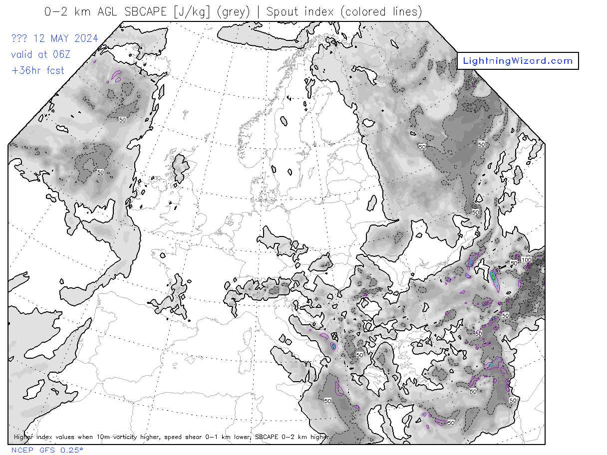
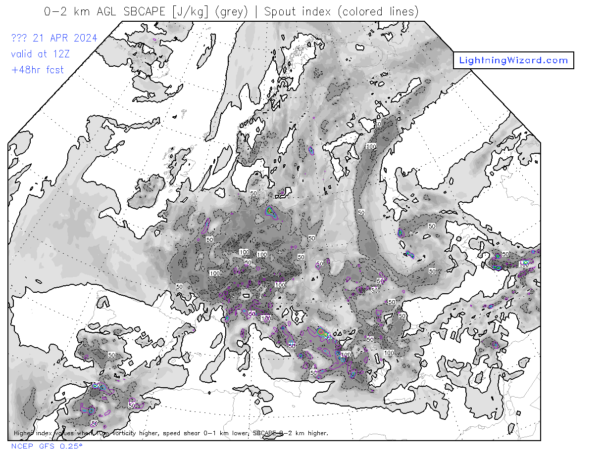
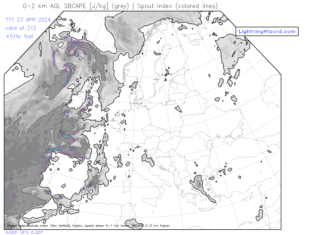
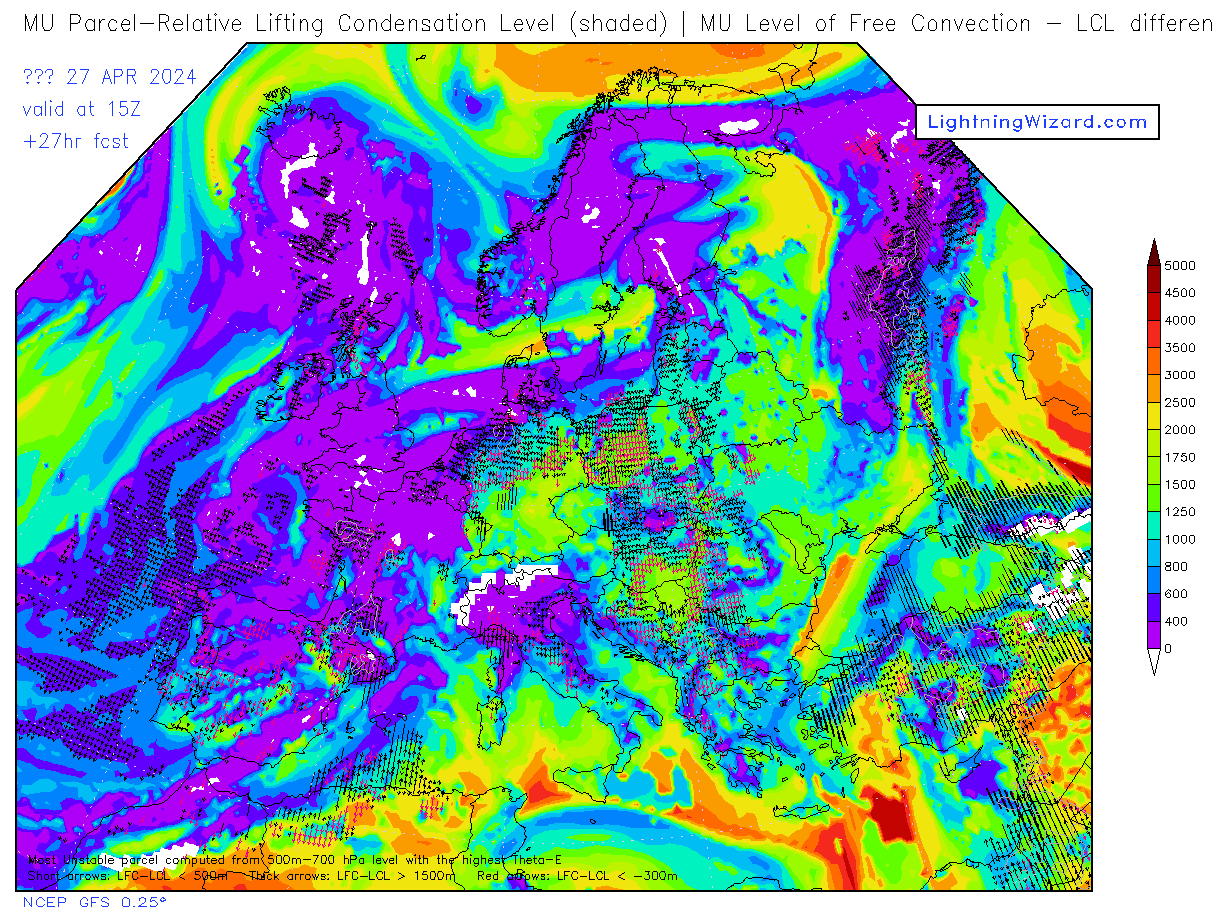
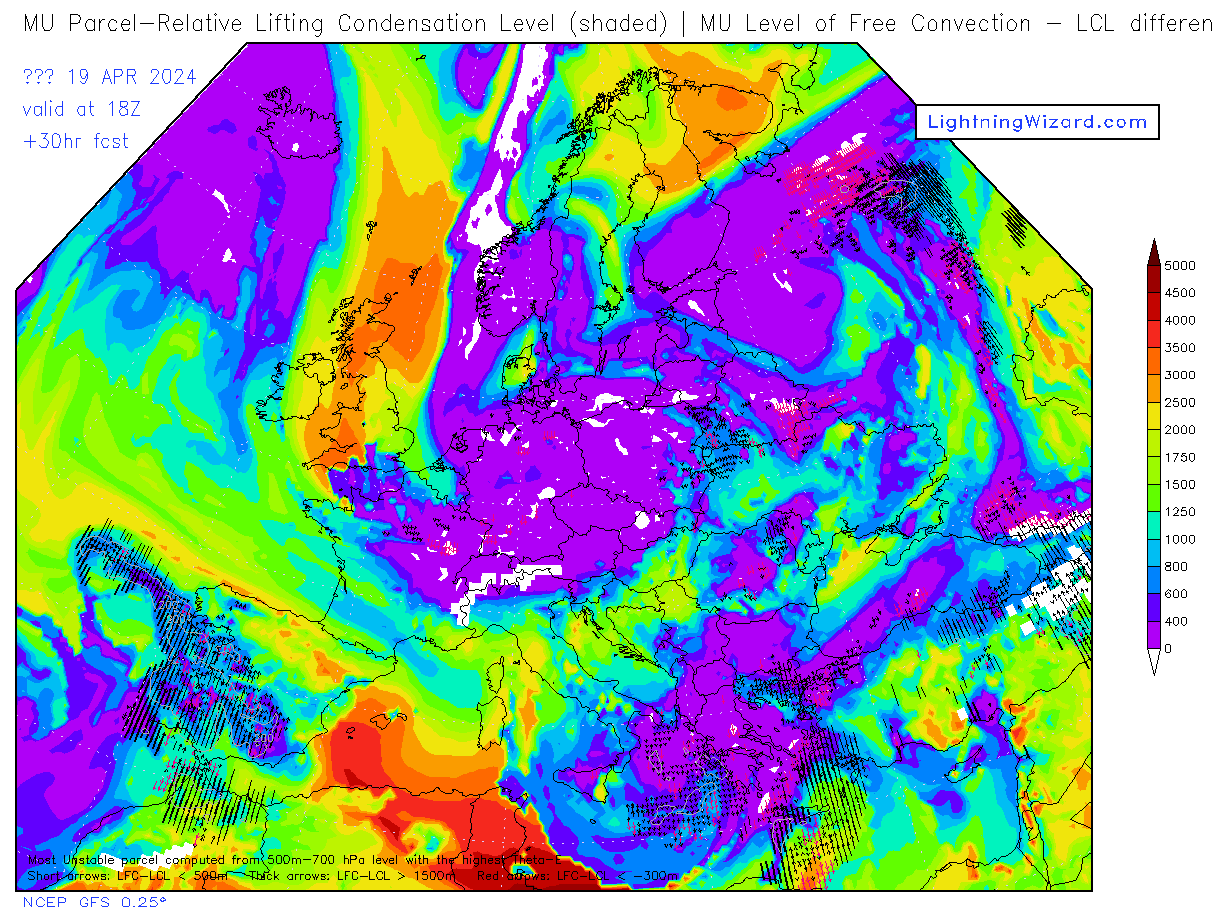
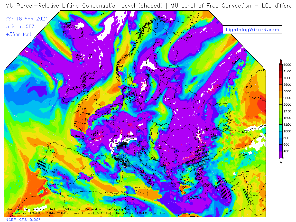
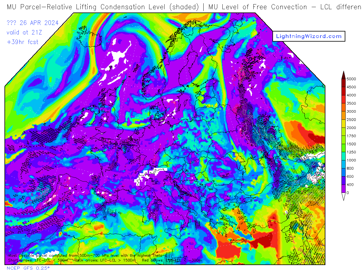
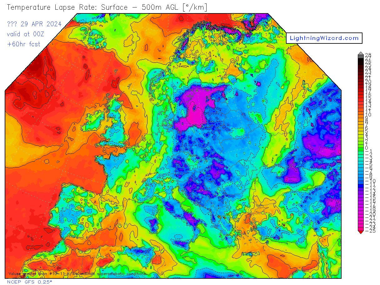
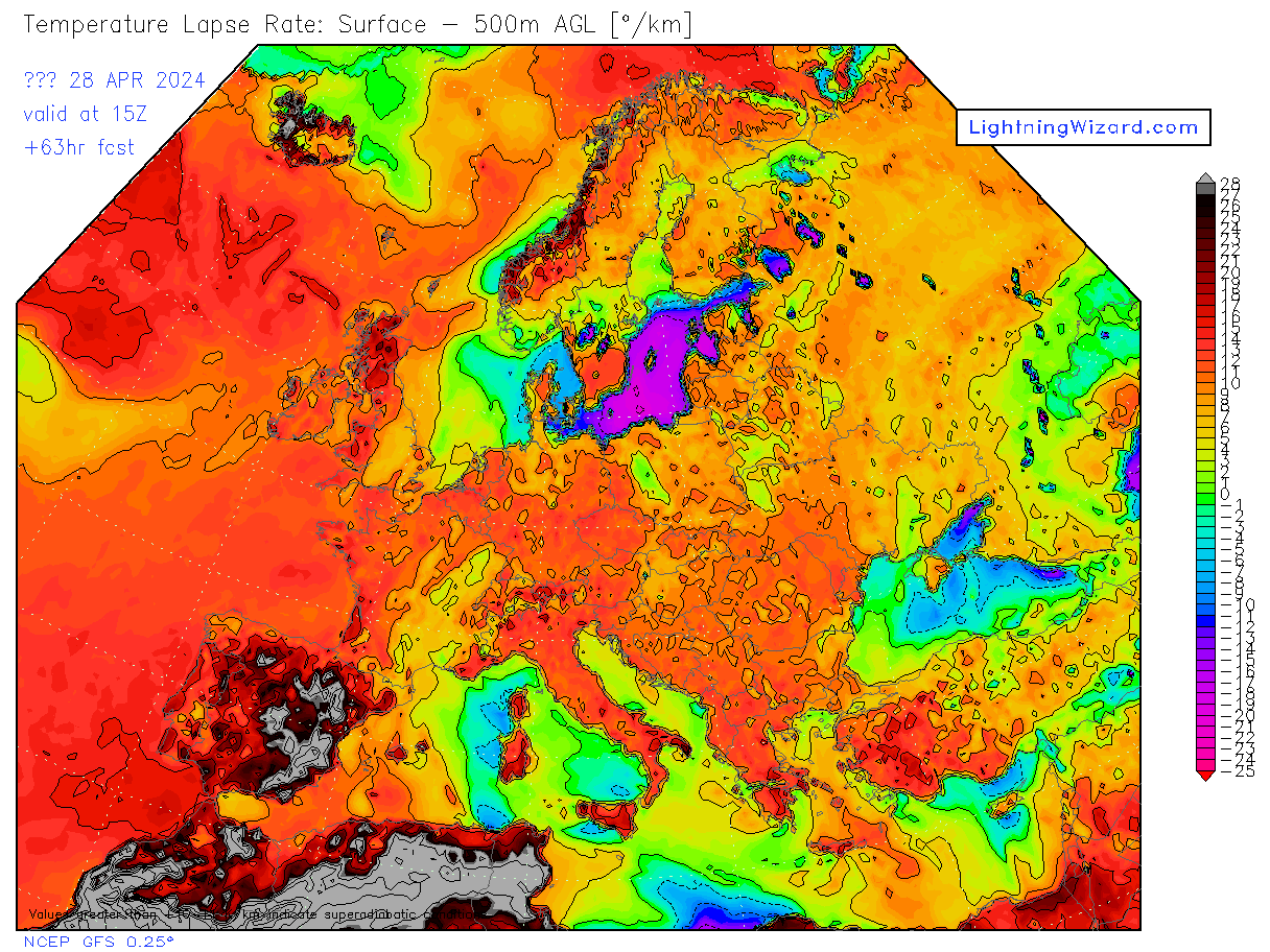
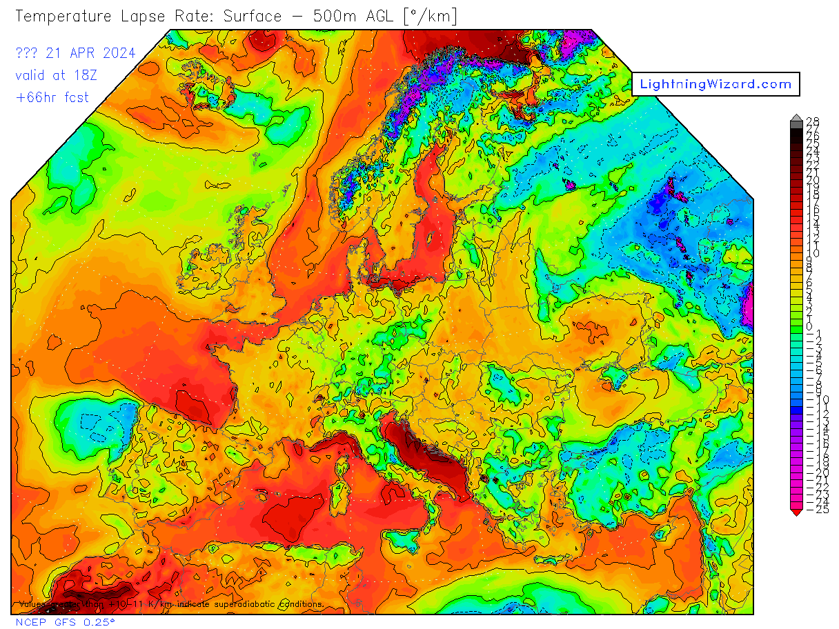
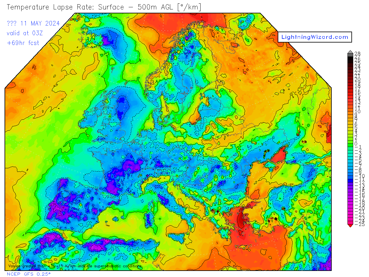
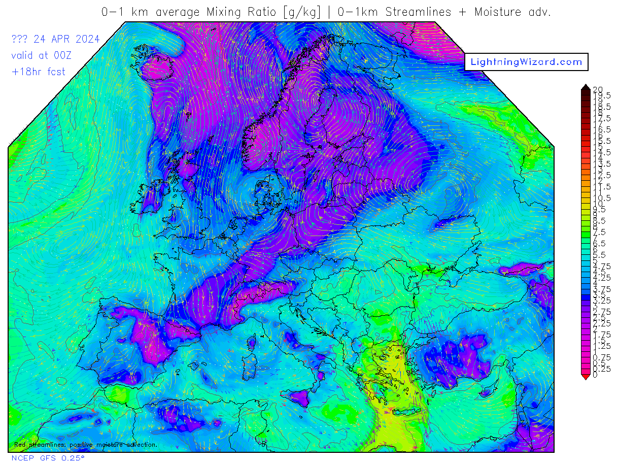
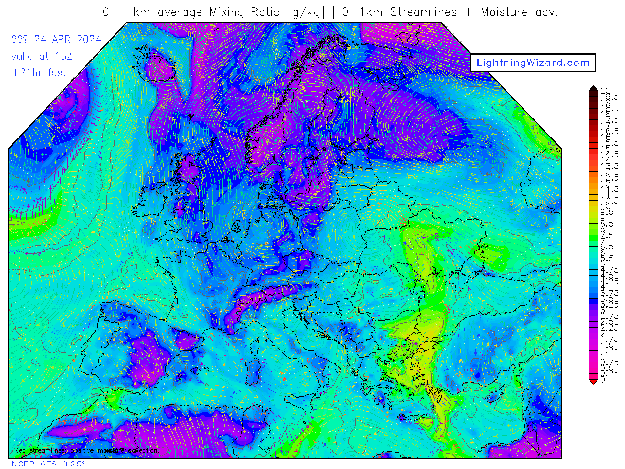
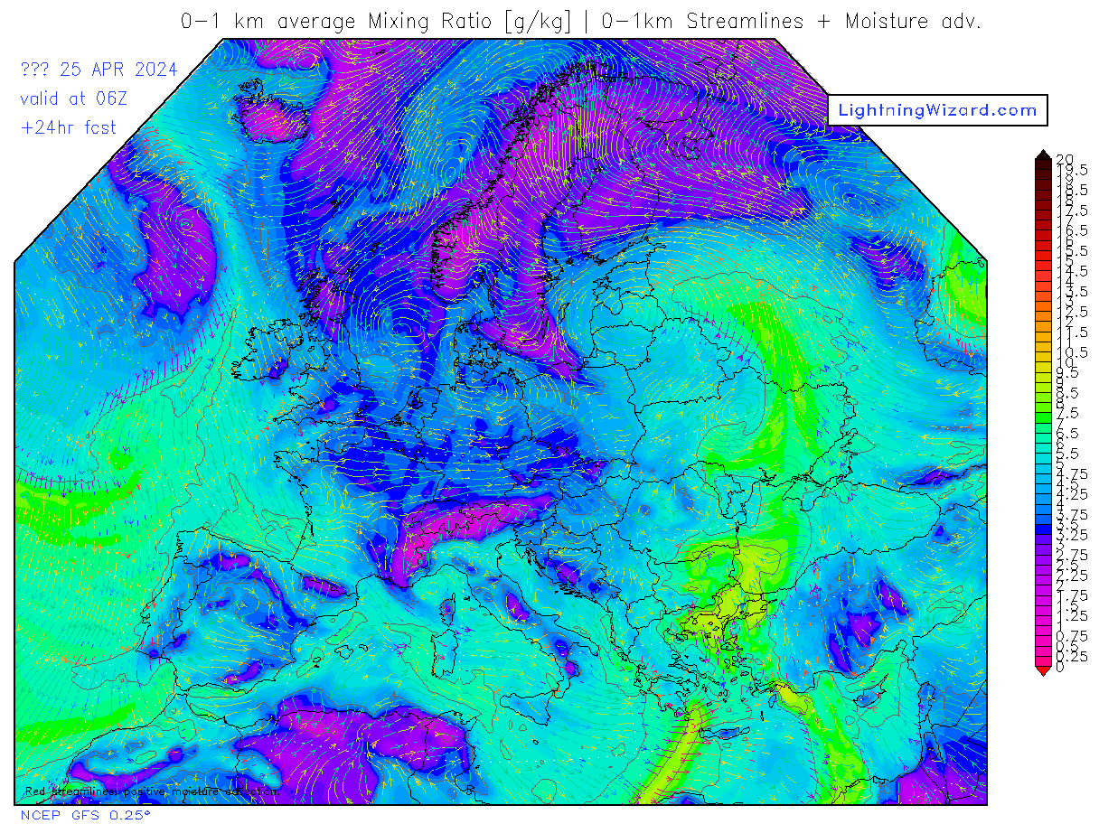
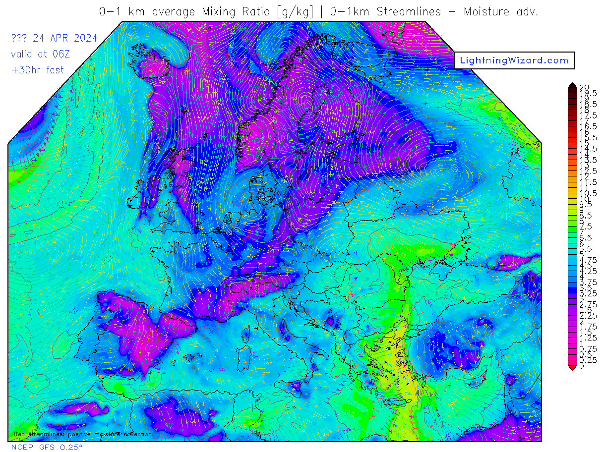
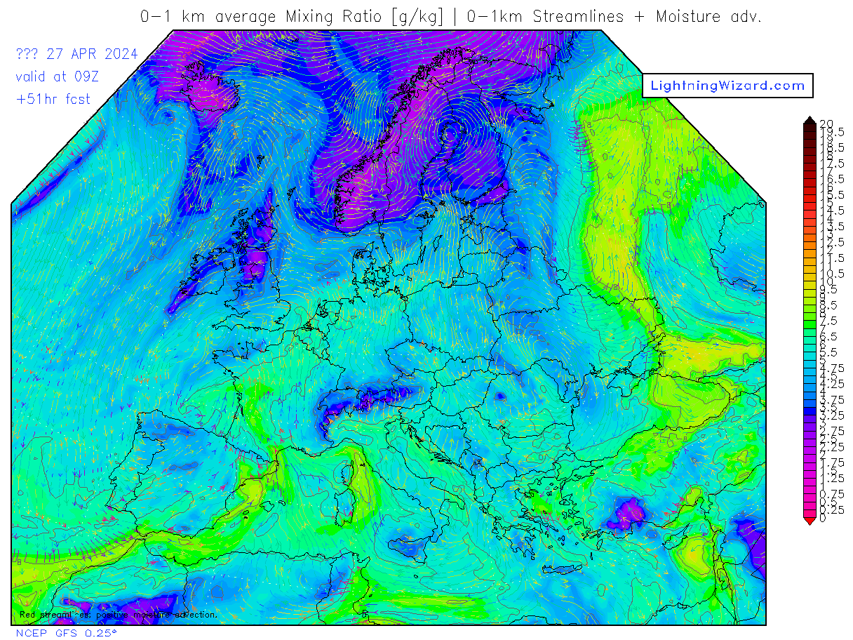
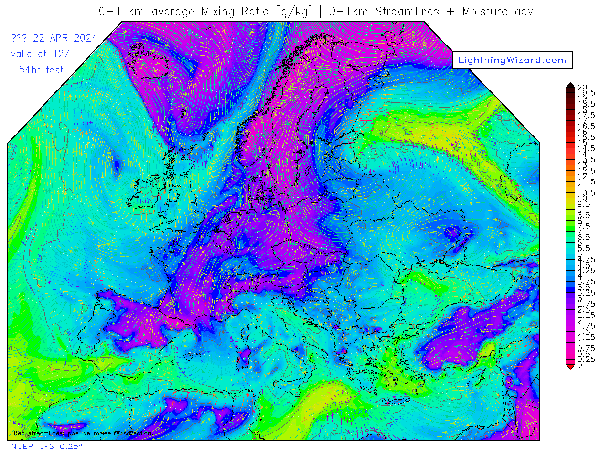
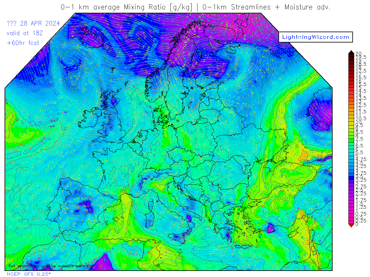
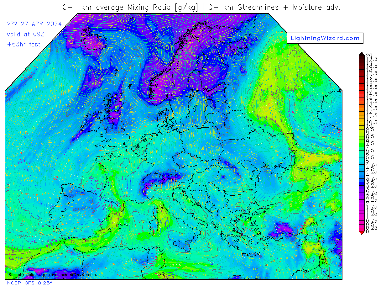
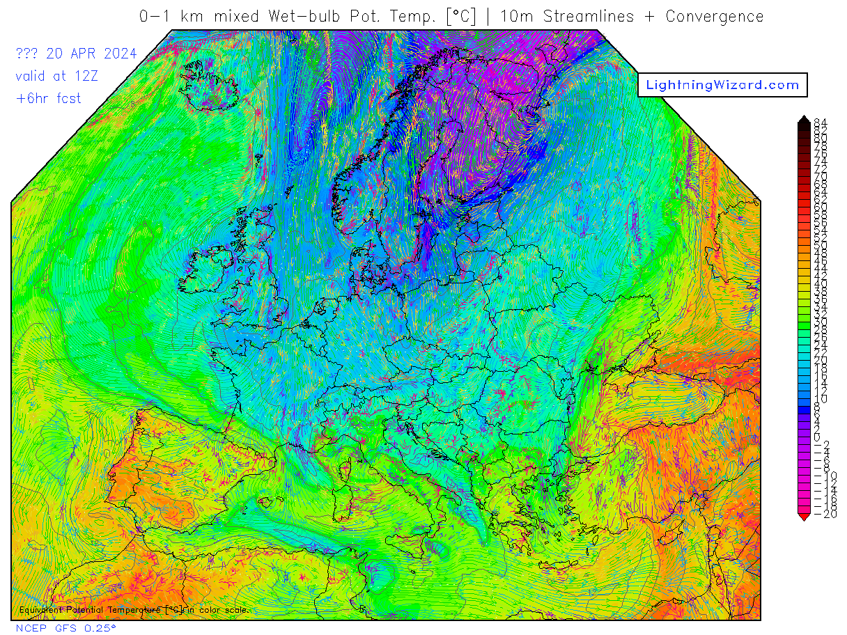
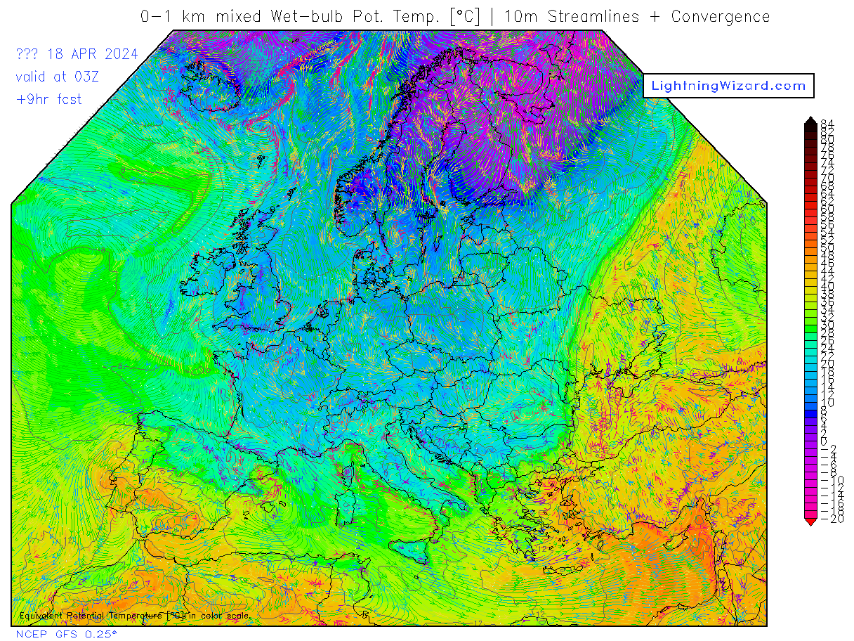
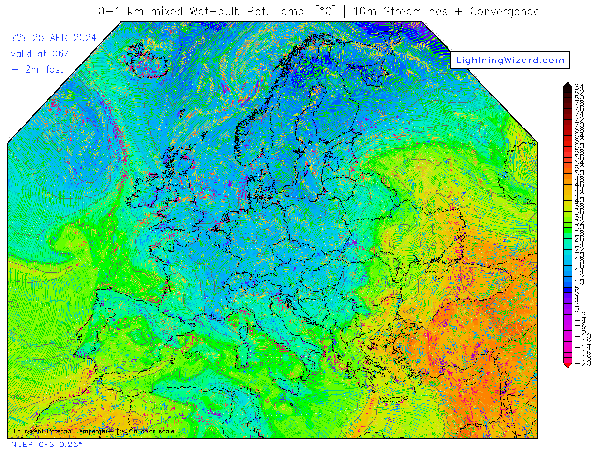
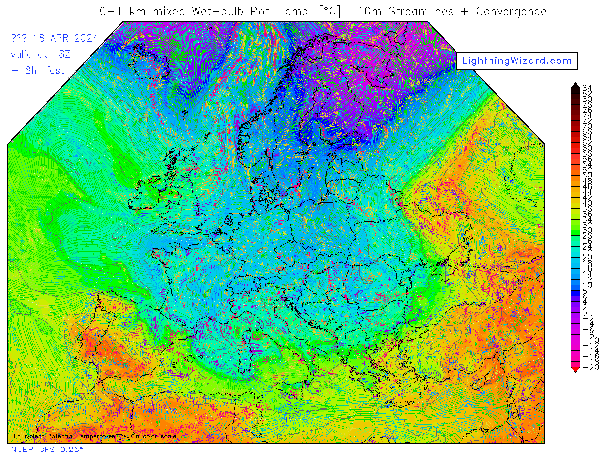
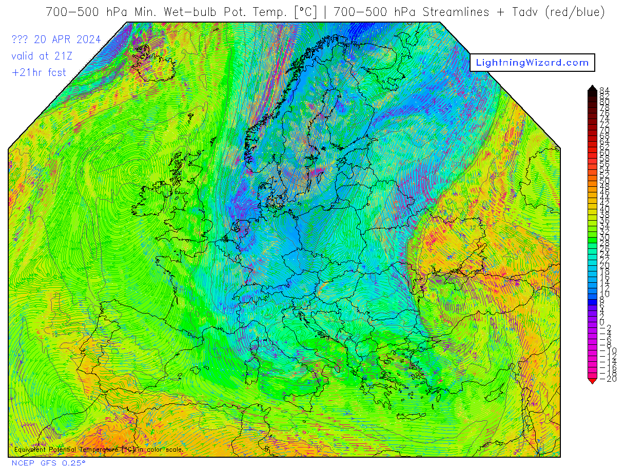
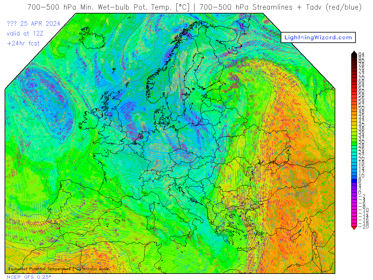
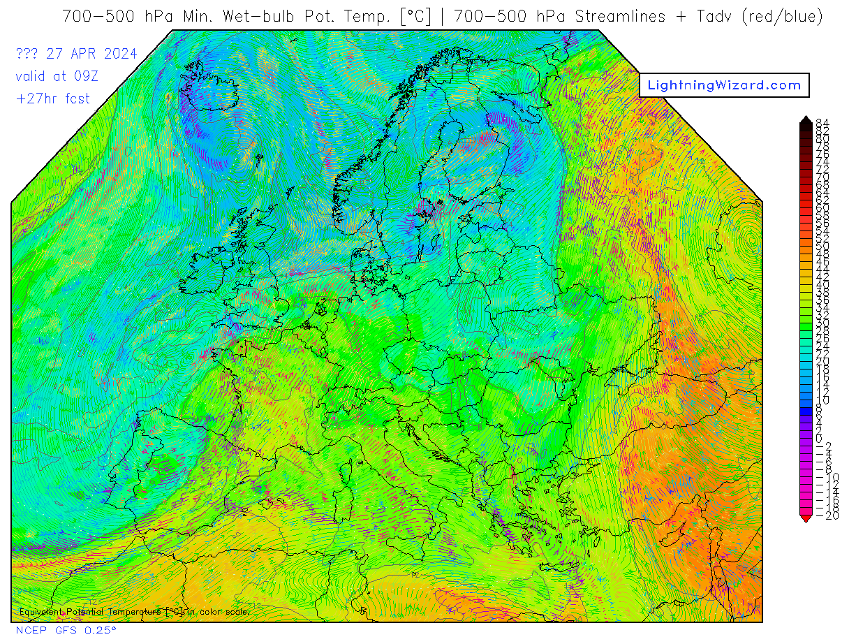
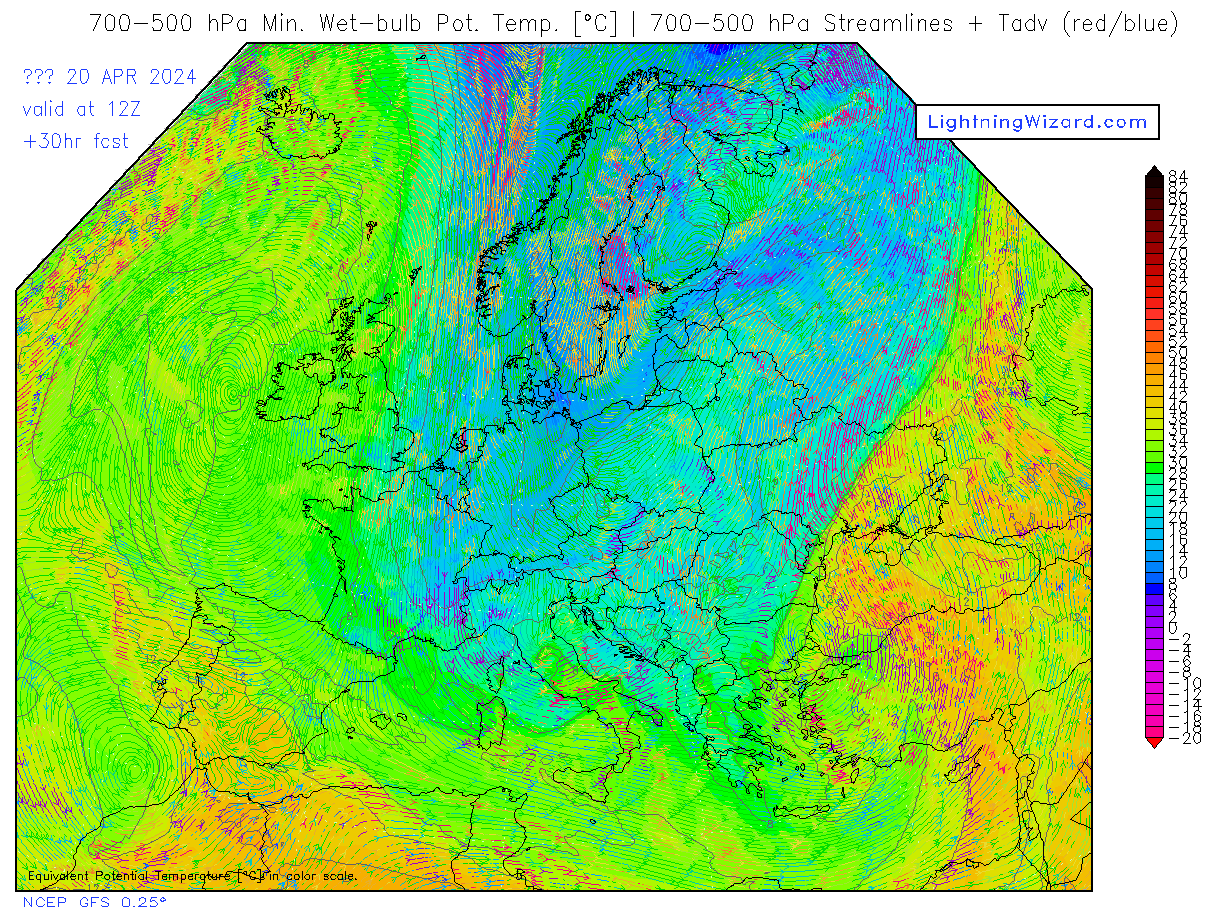
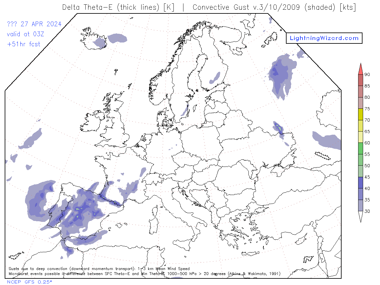
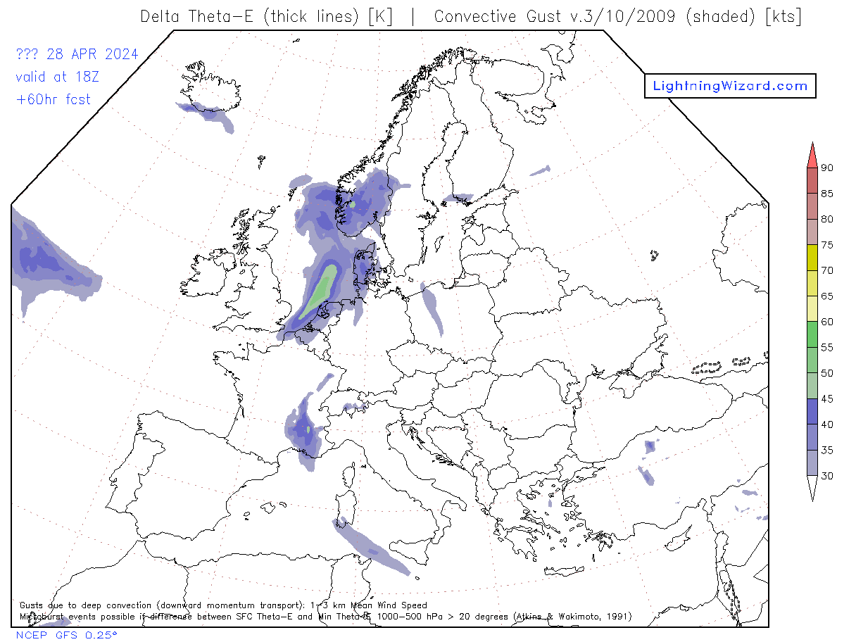
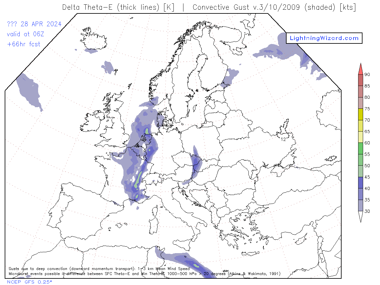
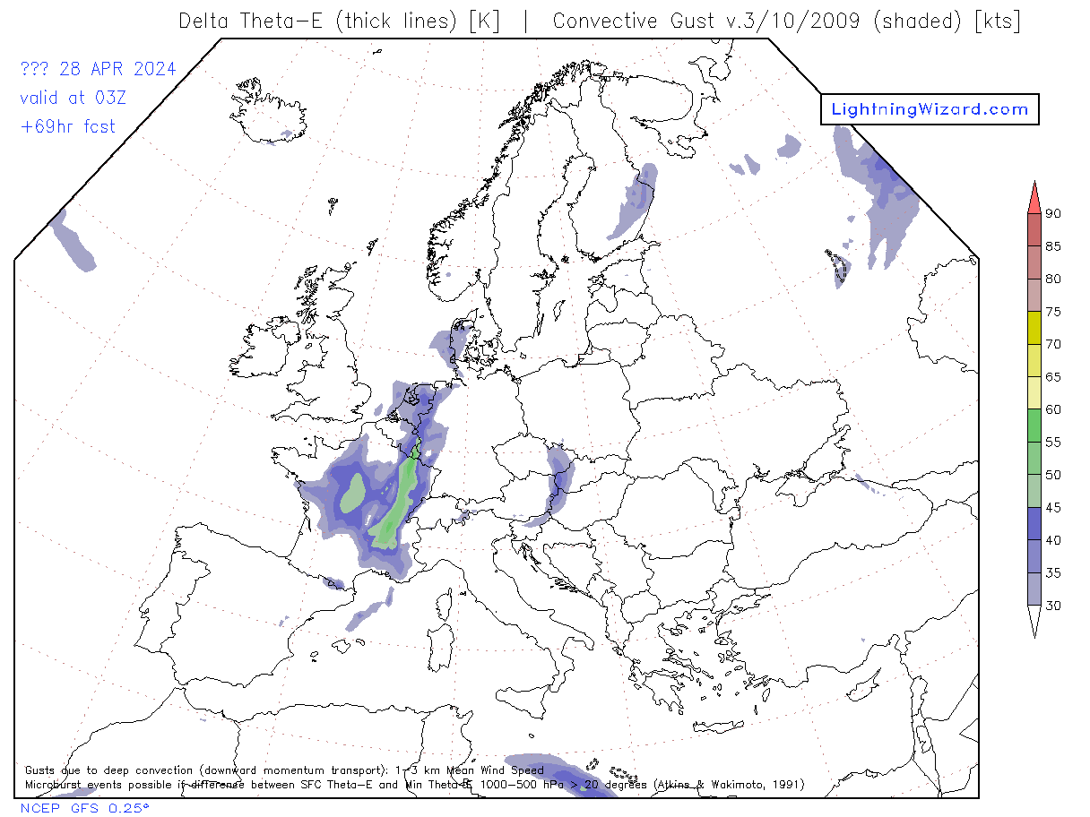
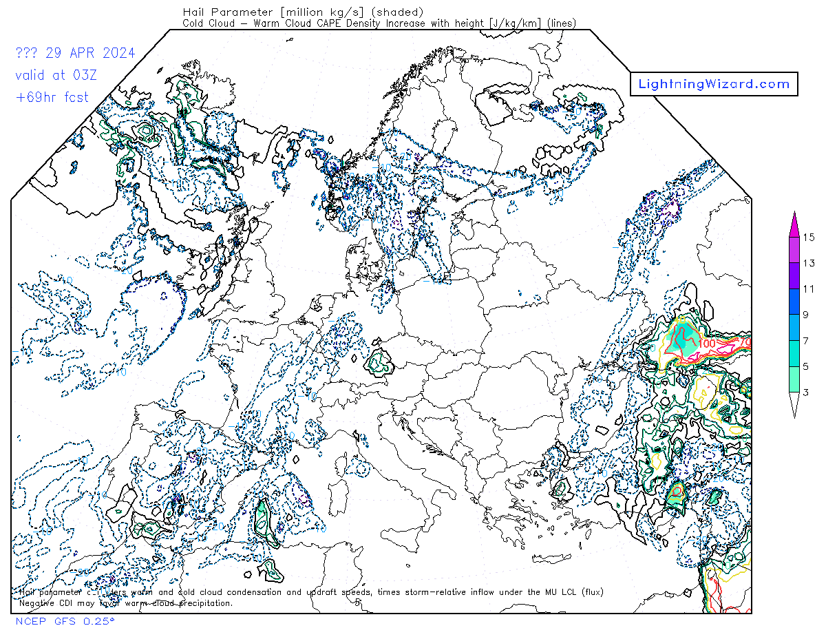
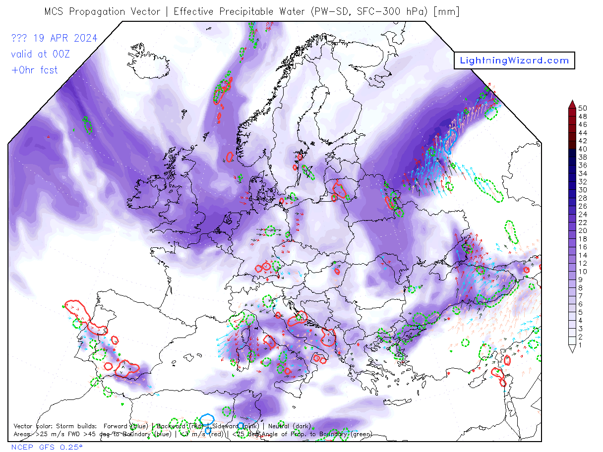
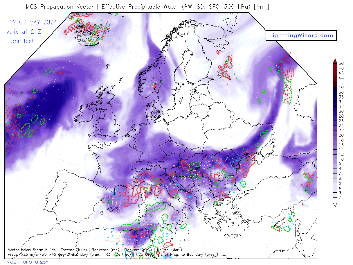
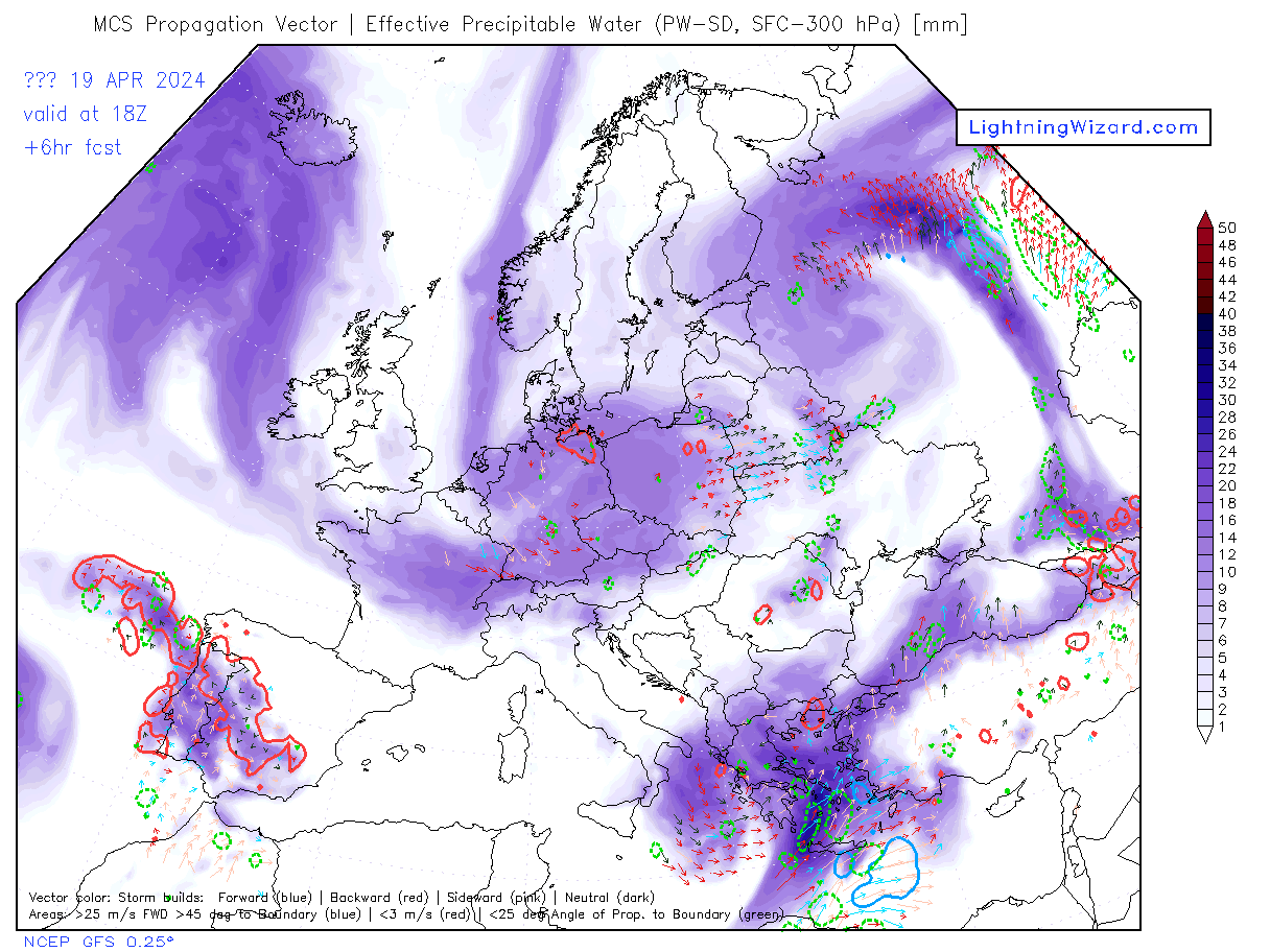
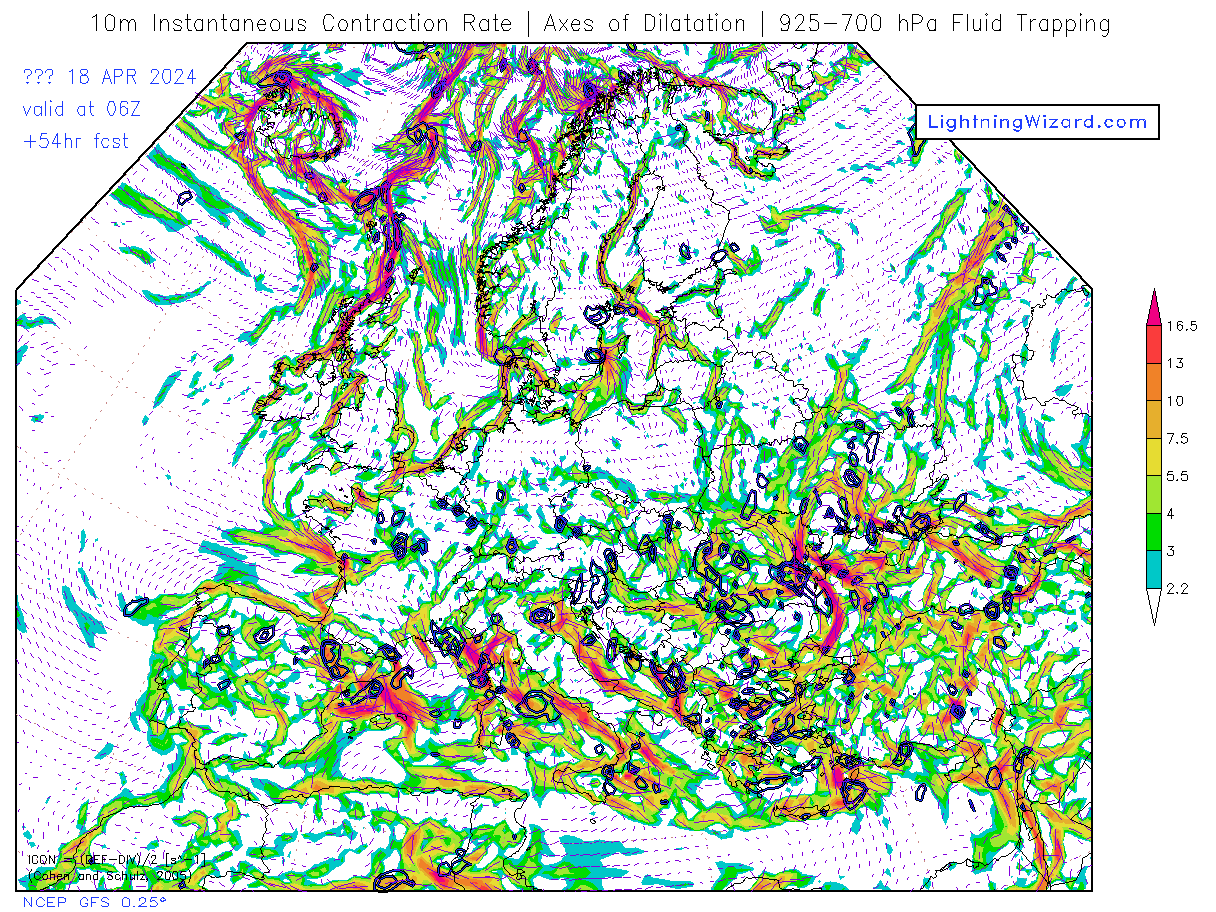
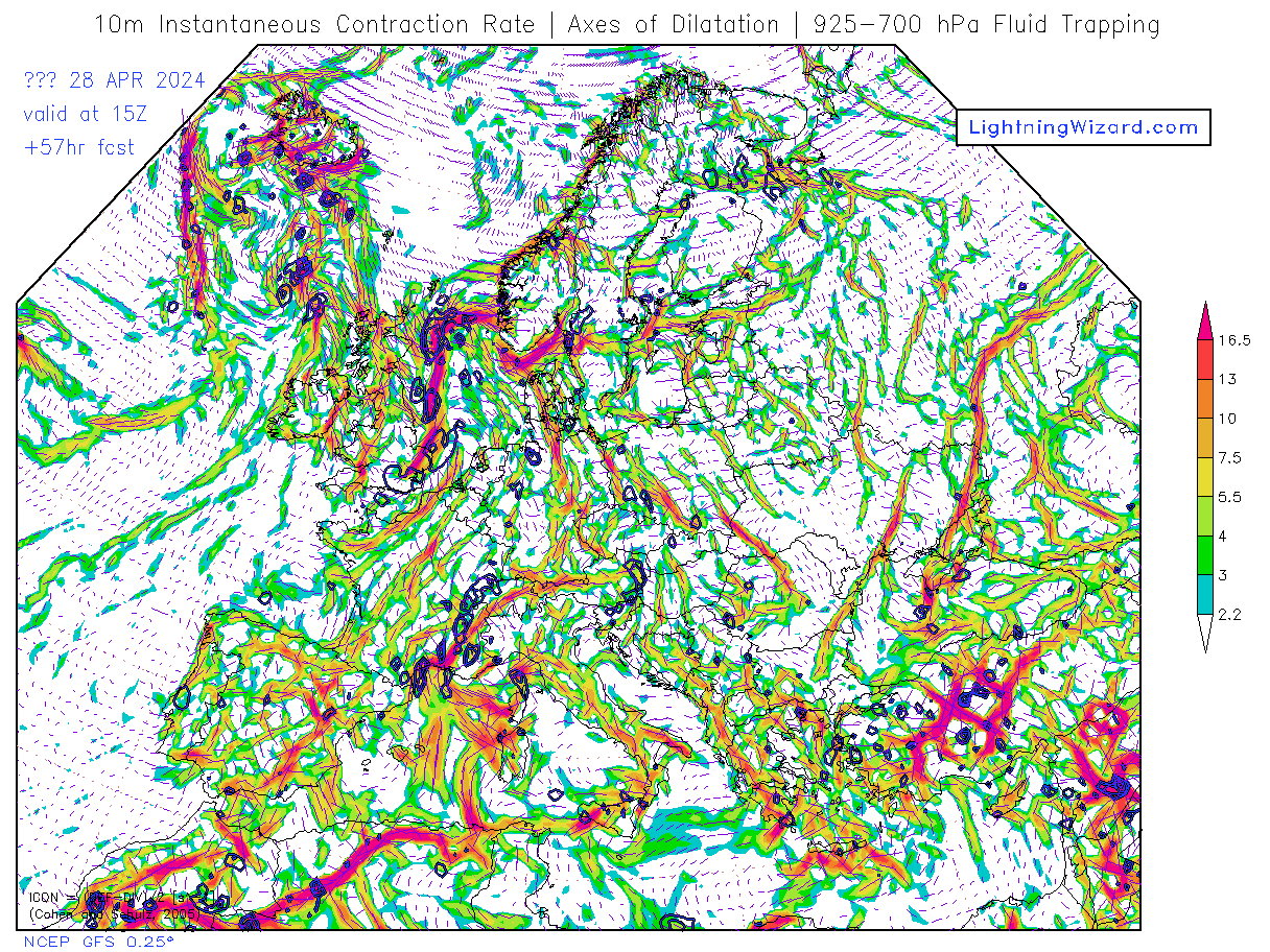
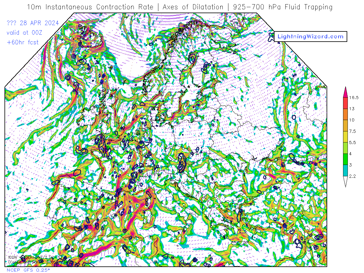
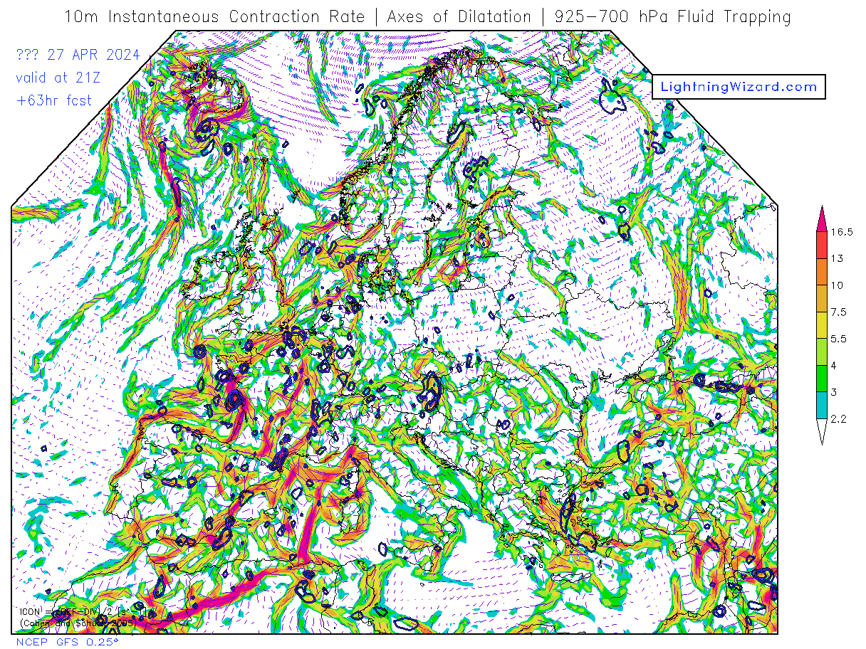
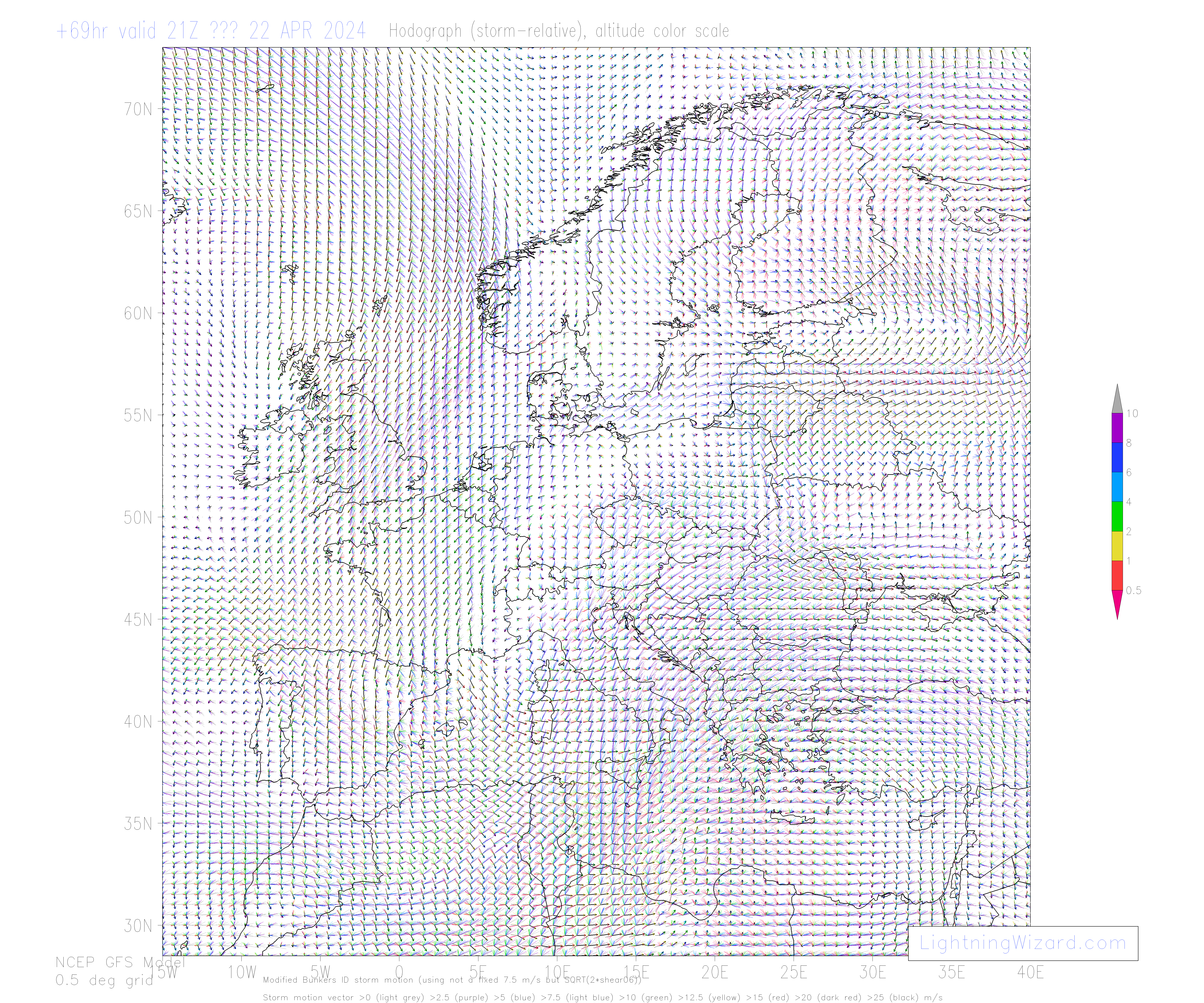
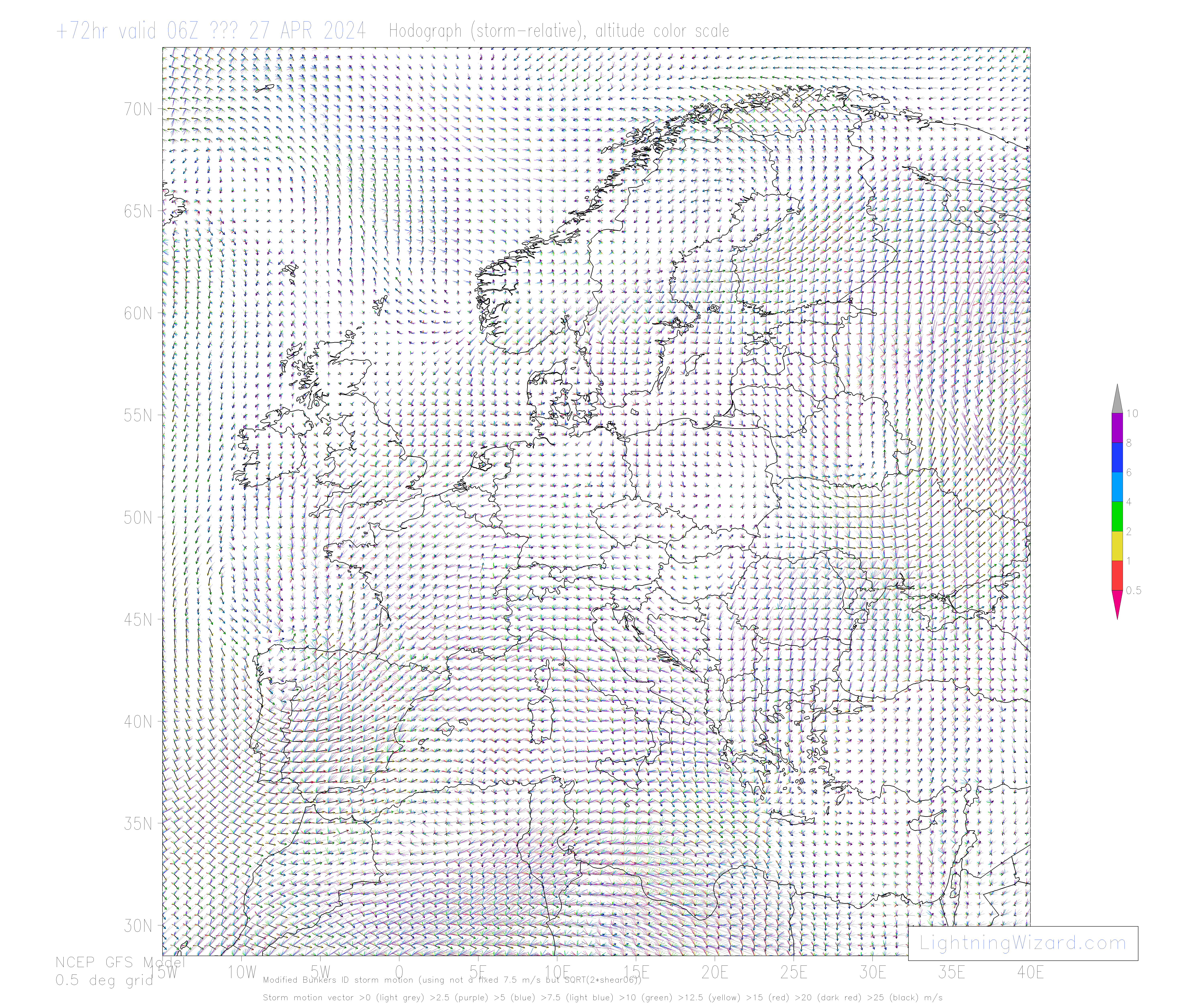
The production of these maps is possible thanks to the free public data policy of the United States of America.
My thanks go to the National Centers for Environmental Prediction and National Weather Service for their reliable service
providing global numerical weather prediction data.
Further thanks: to Pieter Groenemeijer for his automation and interpolation routines, and Felix Welzenbach for his translation of the guide.
This service runs on the server of the European Storm Forecast Experiment
|
See also www.facebook.com/lightningwizardcom
Guide to using Convective Weather Maps [1.9 MB PDF / 8-2007]
|
|
